Live The High Life
Real offroad expeditions, routes, and rallies.
Live The High Life
Real offroad expeditions, routes, and rallies.
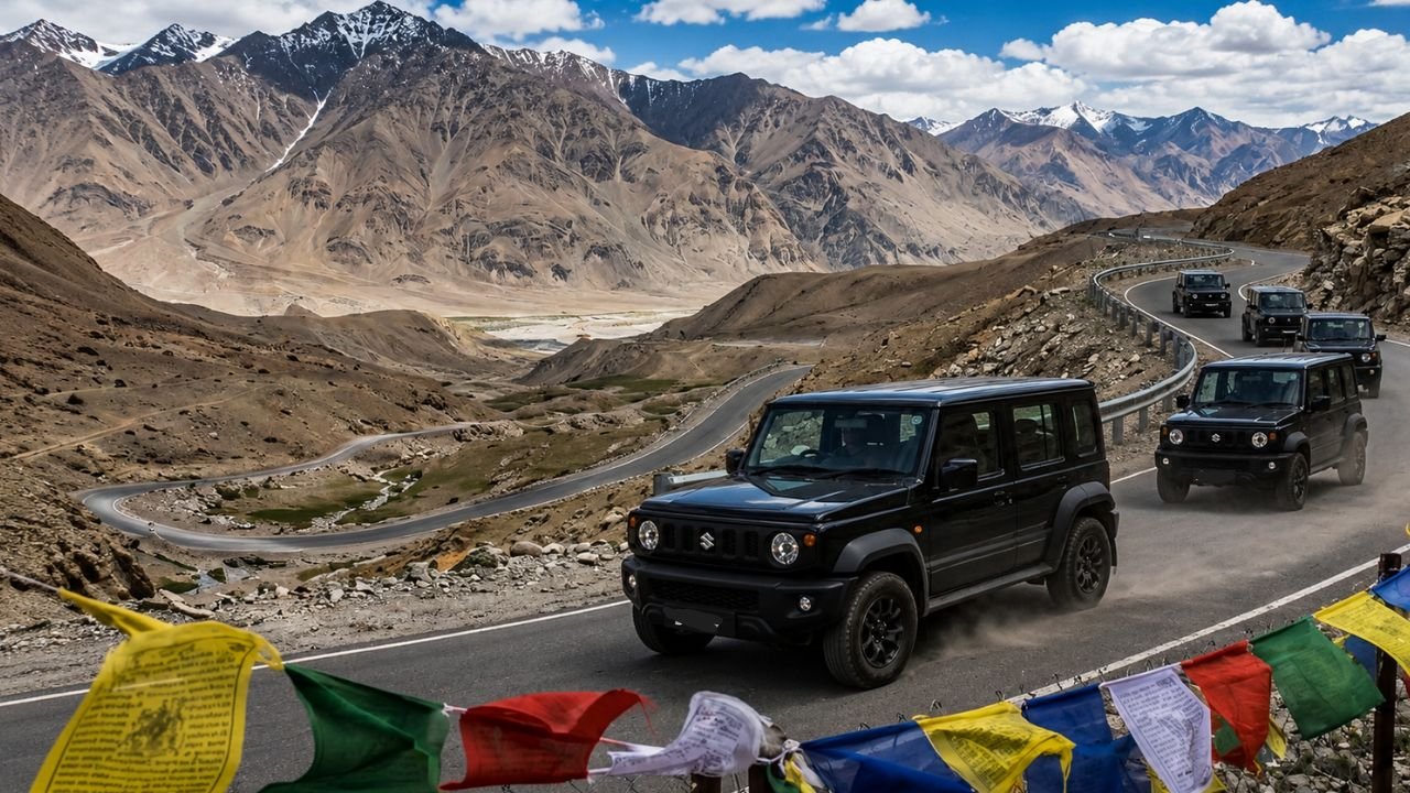
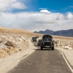
Let’s clear up a massive lie first. If you think driving over Khardung La or Chang La in a rental hatchback makes you a hardcore mountain explorer, you are wrong. True adventure doesn’t live on smooth tourist highways. It lives where the tarmac ends, where your phone screen says “No Service,” and where you have to engage 4-Low just to stay on the edge of a cliff.
Welcome to the Eastern Ladakh Border Circuit (The East Side).
Most travel bloggers will point you toward Pangong Tso or Nubra Valley. We say skip them. If you look closely at Google Maps satellite view right along the China border (the LAC), you will find a wild wilderness of open plains, sand tracks, and dry river beds centered around a small village called Hanle.
This is the real “Land of High Passes.” By making Hanle your base camp for 7-10 days, your 4×4 can conquer routes that less than 1% of drivers in India even know exist.
Eastern Ladakh is a high-altitude desert sitting above 14,000 feet. The terrain changes every 20 kilometers. One hour you are crawling over sharp, tyre-slashing mountain rocks, and the next hour you are powersliding through soft sand dunes or crossing freezing water streams.
Normal cars cannot breathe here, and front-wheel-drive crossovers will break their axles. You need high ground clearance, a proper low-range transfer case (4L), and a brain that doesn’t panic when the gaddi slips.
We have broken this entire border circuit down into four specific battlegrounds. Each one of these darras (passes) requires respect, preparation, and solid driving skills:
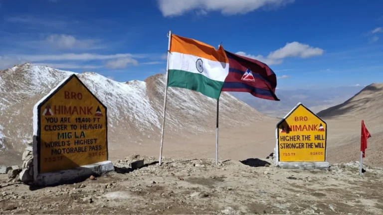
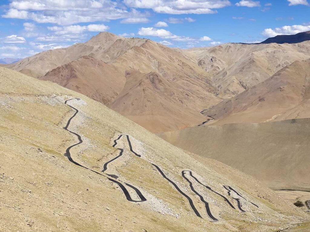
Move over Umling La, there is a new boss in town. Running along the Likaru-Mig La-Fukche military alignment, Mig La is officially the highest motorable road on the planet. The track is mostly loose gravel, broken scree, and steep inclines where the air has less than 45% oxygen. Your engine will lose power, and your tyres will scream for traction.
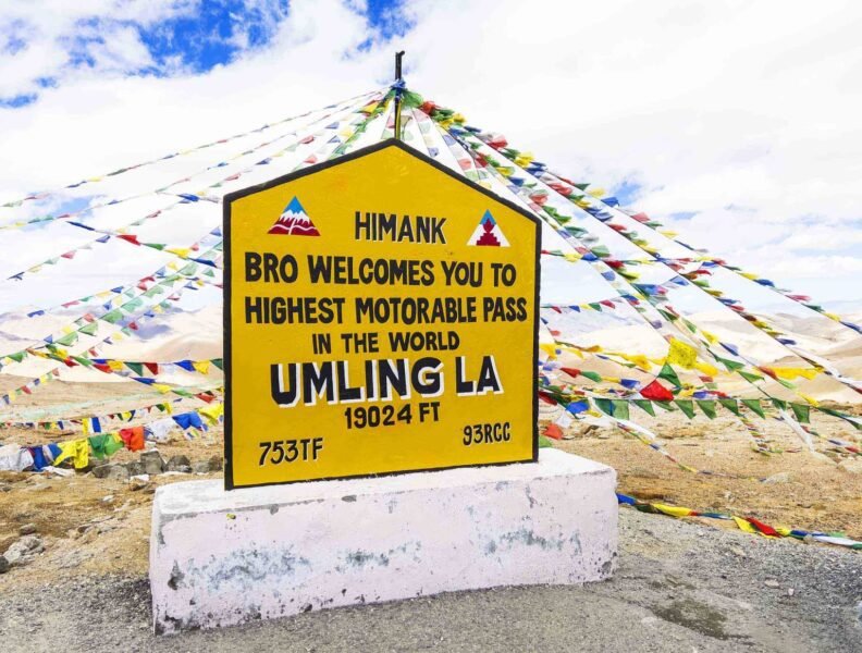
Any tourist can take the smooth tar road to Umling La from Chisumle. But that’s boring. The real way to do it is to take the dirt track climbing straight out of the back of Hanle village over Photi La Pass. It is a steep, mitti-wali trail with brutal crosswinds. Once you drop down the other side, you immediately begin the grueling climb up to the mighty Umling La.
Read More:- Umling La Pass: Route, Height, Weather, Map & Complete Travel Guide
If you look at the southern bottom of your satellite map, you’ll see pure emptiness. This is the Ukdungle-Nerbole wilderness. There are no roads here—only faint tyre tracks left by military trucks in the sand. Navigating here requires pre-downloaded offline maps and a co-driver who knows how to spot deep sand traps before the vehicle sinks to its belly pan.
Driving to the absolute edge of India. To reach Koyul, you have to leave the dirt tracks behind and drive your 4×4 directly onto the wide, pebble-strewn dry beds of the Indus River. From there, you skim the Line of Actual Control (LAC) all the way to Demchok, where you can literally see Chinese military watchtowers right across a narrow water stream.
Because HighDairies is an actual off-roading community and not a generic lifestyle blog, we aren’t going to tell you to “enjoy the views.” We want you and your vehicle to come back in one piece. Remember these three things:

Are you planning to take a Thar, a Gurkha, a Hilux, or a Jmny into this extreme eastern wilderness? What tyres are you running? Drop your vehicle setup and your questions in the comments on social media, and let’s talk shop!
– Team HighDairies | Jimny Club Haryana