Live The High Life
Real offroad expeditions, routes, and rallies.
Live The High Life
Real offroad expeditions, routes, and rallies.
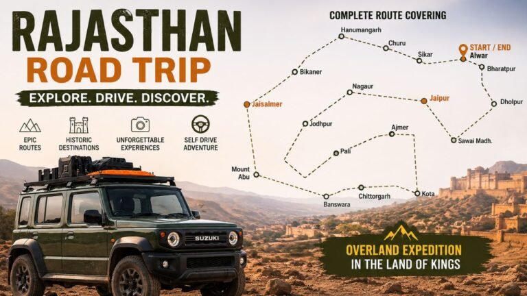
East Ladakh Expedition 2026 Route: Chandigarh to Manali to Shinku La to Zanskar to NPD Road to Leh to Khardung La to Nubra to Wari La to Pangong to Chushul to Hanle to Umling La to Demchok to Koyul to Salsal La to Charchagan La to Tso Moriri to Manali
Start Date: 19 June 2026 | Total Distance: ~3,000 km | Passes: 20+
I am going to say something that most Ladakh travel content will never say.
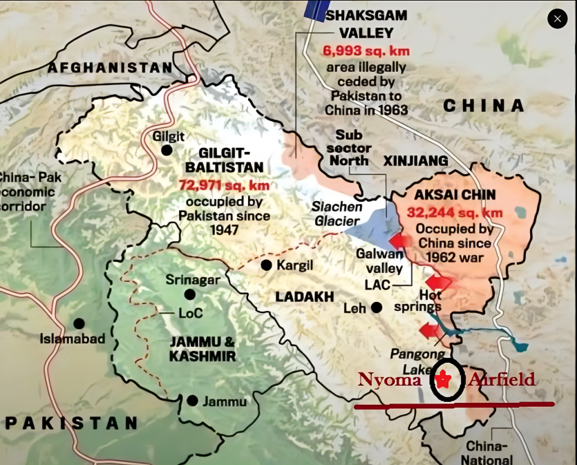
The part of Ladakh that most people visit — Leh, Nubra, Pangong, Tso Moriri — is the easy part. It is beautiful, yes. It is worth doing, yes. But there is a deeper layer to East Ladakh, a corridor that runs south of Pangong along India’s border with China, that almost nobody explores properly.
The villages of Hanle, Koyul, and Demchok. The passes of Nurbu La, Thit Zarbo La, Salsal La, and Charchagan La. The twin lakes of Ryul Tso and Chilling Tso hidden behind Hanle Observatory. The road over Umling La that drops into Demchok village — a place split between India and China since 1962 — and the Indus River flowing right alongside the Line of Actual Control.
That entire region is what this trip is built around. I am leaving Chandigarh on 19 June. This is the full plan. If you want to join, bring a proper 4×4 and start preparing now.
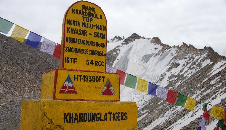
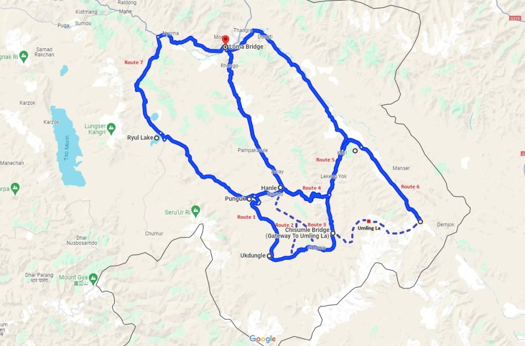
We enter Zanskar from Manali via Shinku La, come out of Zanskar directly to Leh via the NPD road crossing Singe La, Bumiktse La, and Sirsir La, then go north to Nubra via Khardung La, across to Pangong via the raw Wari La, and south from Pangong through Chushul into the deep East Ladakh corridor. From there we spend five days properly exploring Hanle, the hidden lakes, Umling La, Koyul, Demchok, and finally exit to Tso Moriri via Thit Zarbo La, Salsal La, and Charchagan La before returning to Manali on the main highway.
Highway day. Leave before sunrise and you will be in Manali by early afternoon. Use the rest of the day for preparation: full tank of diesel, jerry cans filled, vehicle checked, provisions stocked. Manali is the last real city for the next one and a half weeks. After Keylong the infrastructure disappears fast.
Stay: Hotel, Manali
Atal Tunnel, Sissu, Keylong. Fill fuel completely at Keylong — between here and Padum there is no pump for over 200 km. At Darcha the tarmac ends and the adventure begins.
The Darcha to Padum road was completed by BRO in 2024 and is still being widened in sections. In June it is open for 4×4 vehicles. The track climbs through loose gravel and stream crossings before the final push to Shinku La at 5,091 metres. Stand at the top. Look back at Lahaul. Look forward into Zanskar. These are two completely different worlds separated by one pass.
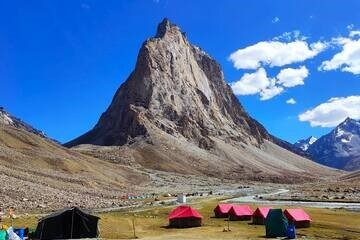
Descend to Gonbo Rangjon — an isolated rock formation with a small monastery perched on it. No hotel. No phone signal. Camp under a sky that most people never see in their lifetime.
Stay: Wild camping, Gonbo Rangjon
Short diversion to Phugtal Monastery before reaching Padum. This is a 2,500-year-old monastery built directly into a cliff face — literally inside a natural cave in the rock wall. Until a few years ago reachable only by a two-day trek. Drive as close as the road allows, walk the last stretch, spend an hour here.
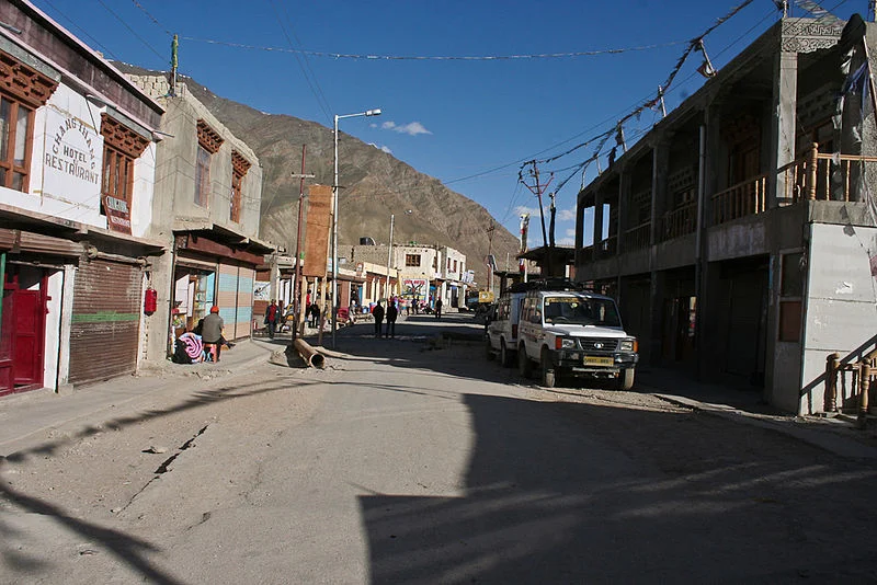
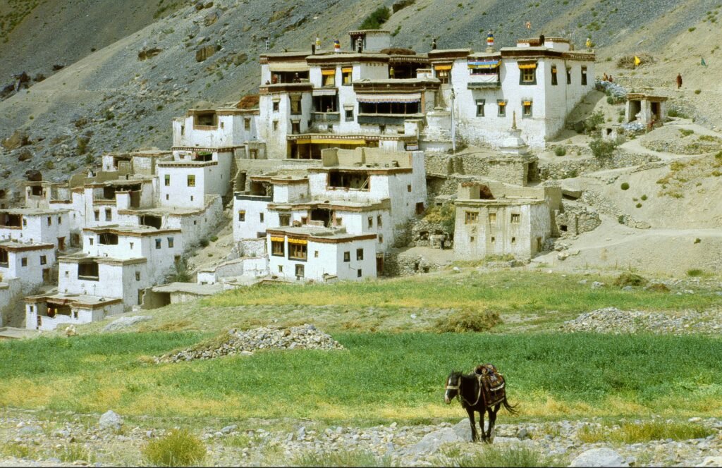
Padum is the main settlement in Zanskar Valley. Fill fuel — there is a pump near town. This is your last reliable source before the NPD road. Visit Karsha Monastery in the evening, the largest in Zanskar, on a hillside above the valley.
Stay: Guesthouse or homestay, Padum
Singe La — 4,200 m / 13,780 ft, Bumiktse La — 4,200 m / 13,780 ft
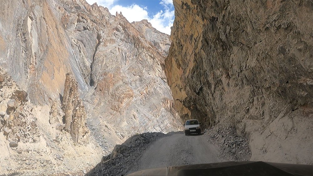
The NPD road east of Padum is what most overlanders in India still do not know is driveable. It follows the Zanskar River gorge through vertical canyon walls — the same corridor that Chadar Trek trekkers walk on frozen ice in winter. BRO connected the full route in March 2024 and sections remain rough.
Turn right from Padum towards Zangla. First 40 km is decent. After Zangla the track narrows and the real off-roading starts. Singe La arrives first — steep switchbacks, loose surface, commanding views. Bumiktse La follows shortly after. Both sit in scenery that has no equivalent on the standard Ladakh circuit.
Lingshed by evening. This ancient village and monastery was accessible only by trekking until two years ago. You have just driven what was a trekking route.
Stay: Homestay, Lingshed
Sirsir La — 4,808 m / 15,774 ft , Wan La — ~4,100 m / ~13,450 ft
Through Photoksar village then up to Sirsir La at 4,808 metres. The road is rough and the drops are steep but after Singe La it feels manageable. Descend through Hanupatta to Wanla where you join the Srinagar-Leh national highway near Khaltse. Fast drive along the Indus into Leh.
Arrive by afternoon. Hotel, hot shower, proper meal. Tonight is permit night — apply on lahdclehpermit.in, select Zone 13 for the full East Ladakh corridor.
Stay: Hotel, Leh
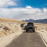
Conquer the steep Chang La Pass (17,590 ft). Skip the crowded Spangmik tourist hubs and drive further down the lake to Man or Merak village for a quiet lakeside homestay.
A pure off-road dirt track right along the shoreline of Pangong Tso. Engage 4H where sand patches get deep. Visit the historic Rezang La War Memorial in Chushul to honor the 1962 martyrs. Stay in a local Chushul homestay.
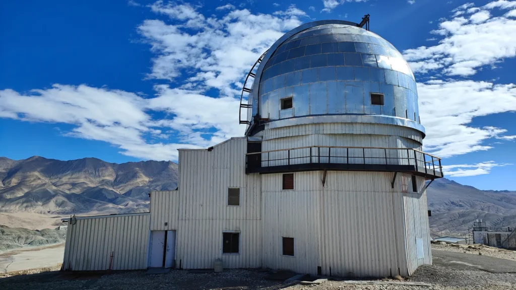
Cross the Tsaga La pass and pass the Loma checkpost. The terrain transforms into the vast, flat tarmac plains of the Changthang cold desert. Arrive in Hanle, home to the World’s Highest Gamma-Ray Telescope.
South from Chushul on the Tsaga La road. The surface is a mix of dirt track, gravel, muddy patches, and occasional quicksand sections between Chushul and the pass — all manageable in a 4×4 with patience. The landscape is completely open: wide flat valleys, distant ridges, army checkposts, almost nobody else on the road.
After Tsaga La the surface improves. Through Tsaga village to Loma junction, then south to Hanle.
Hanle in late afternoon: whitewashed houses, 17th-century monastery on the hill, silver domes of the Indian Astronomical Observatory. This is India’s Dark Sky Reserve — at 4,300 metres in one of the driest and least light-polluted locations in the country, the night sky here is categorically different from anywhere most people have experienced.
Stay: Homestay, Hanle (Night 1 of 4)
Critical fuel: No pump in Hanle. Nearest is Tangtse 187 km or Karu 240 km. Fill completely at Karu before entering East Ladakh. For the full circuit from this point, you need fuel capacity for approximately 800 km.
Most people who come to Hanle do not know these lakes exist.
From behind the Hanle Observatory, a dirt track climbs into the hills toward Ryul Tso and Chilling Tso — two high-altitude lakes at around 5,000 metres that receive almost no visitors. The drive is 58 km one way through landscape that becomes increasingly raw and desolate the further you go. The lakes are deep blue, completely silent, ringed by mountains, with no other human presence.
This route also connects to the Salsal La road toward Tso Moriri — you will approach that route from the other direction in a few days, and today you get to preview the far end of it.
Return to Hanle in the evening. Night sky observation if conditions allow.
Stay: Homestay, Hanle (Night 2 of 4)
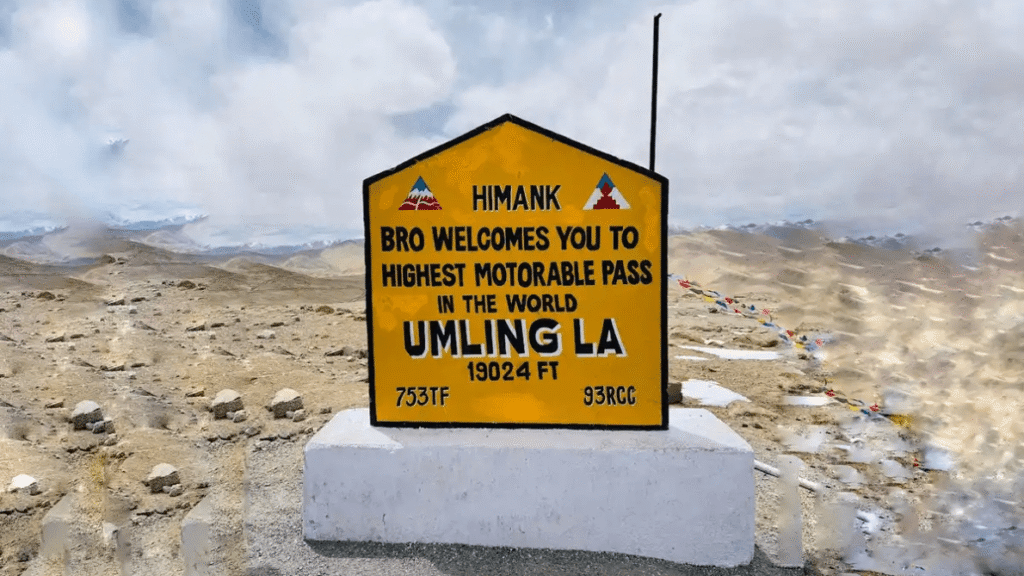
Photila La — ~4,800 m / ~15,748 ft , Umling La — 5,883 m / 19,300 ft
Leave at first light.
From Hanle the main approach goes via Photila La to Photile village, then follows the Indus river valley toward the Chisumle-Demchok bridge and up the final ascent to the summit — roughly 75 km one way. The road is paved in sections and dirt in others. BRO built this as a strategic military road and the final climb to the top is properly paved.
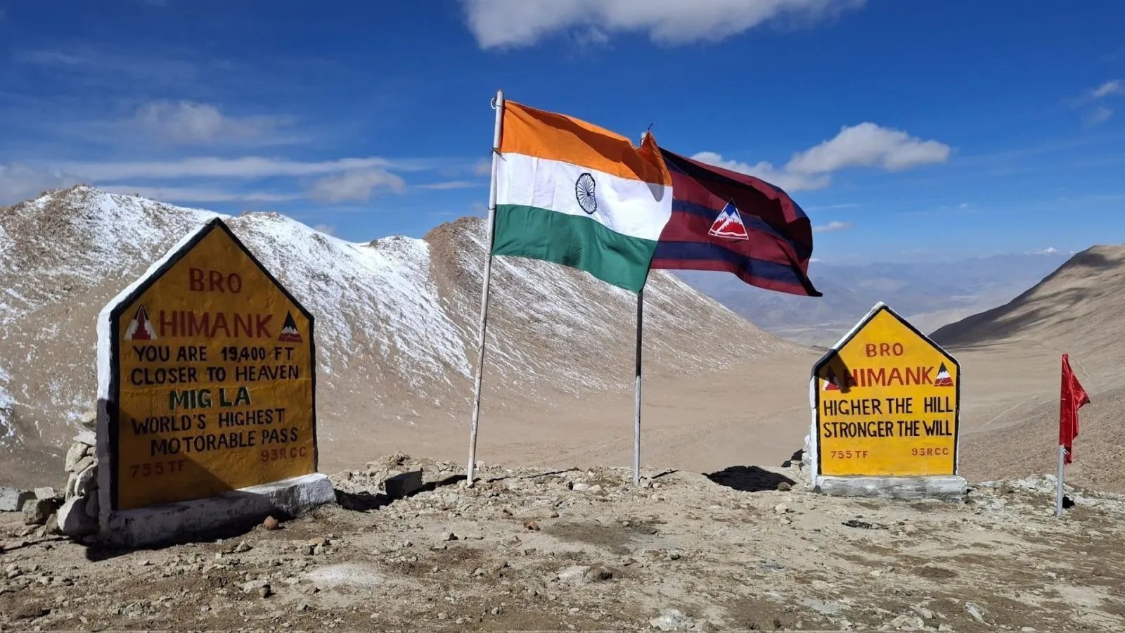
At 5,883 metres — 19,300 feet — you are at the highest point reachable by any vehicle anywhere on earth. Every movement is heavier than it should be. Every breath is deliberate. The summit is completely barren; no vegetation survives here. There is a BRO signboard, the Indian flag, and a view that drops into two completely different valleys on either side.
Note on Mig La: In October 2025, BRO completed the Likaru-Mig La-Fukche road at 19,400 feet, technically surpassing Umling La. As of 2026, Mig La civilian access remains pending Ministry of Defence clearance. If it opens this season, Likaru is near Hanle and we attempt it. Watch the announcements.
Return to Hanle. Second night. Full rest.
Stay: Homestay, Hanle (Night 3 of 4)
Nurbu La — 5,283 m / 17,333 ft
From Hanle, take the Nurbu La route — rougher and higher than the Photila La approach from yesterday — down into the Indus river valley and to Koyul. Nurbu La at 5,283 metres is higher than Khardung La and sees almost no traffic.
At Koyul the road splits. We go south to Demchok.
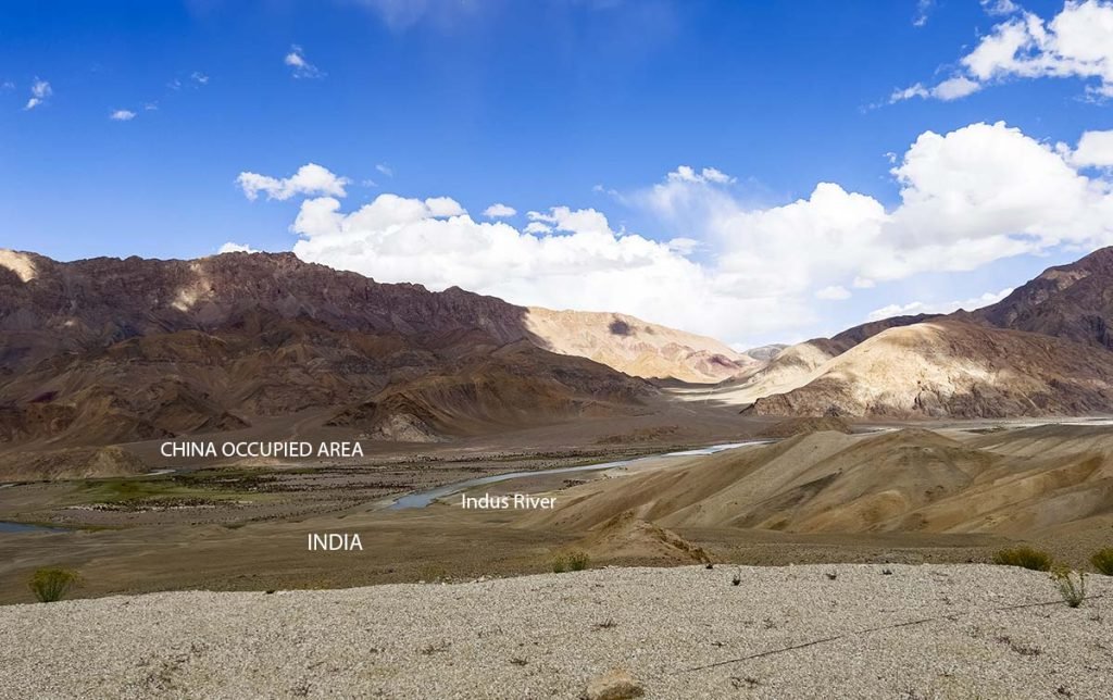
Demchok is a border village divided by the Line of Actual Control since 1962. The Indian and Chinese sides sit across a small river from each other. The Indus runs alongside the road. Chinese military infrastructure is visible across the border. This is one of the most geopolitically significant places a civilian Indian can legally drive to, and it is genuinely unlike anywhere else.
The army checkpost at Koyul controls access. Your permits and documents will be checked. Access to Demchok village itself may be restricted on any given day based on the current security situation — this is real and cannot be planned around. Go prepared, go respectful, be ready to turn around if asked.
Camp at Koyul after returning from Demchok.
Stay: Homestay or camping, Koyul
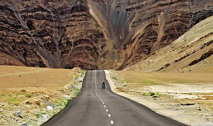
A transition day through the remote southern corridor. The road from Koyul runs west through Dungti and Fukche back to the main Loma-Leh road. This stretch is rarely driven by tourists and runs through deep Changthang plateau with unobstructed views across the border region in every direction.
Fukche has an Indian Air Force advanced landing ground visible from the road. The landscape here has an actively strategic quality — you are aware, constantly, that you are on the edge of something significant.
Continue to Nyoma by evening.
Stay: Basic guesthouse, Nyoma
Thit Zarbo La — 5,111 m / 16,769 ft
From Nyoma, a road climbs east through Nidar village and over Thit Zarbo La before descending to the twin lakes Kyun Tso 1 and Kyun Tso 2 — Chilling Tso and Ryul Tso, the same lakes you saw from the Hanle side on Day 11.
The road over Thit Zarbo La is in poor condition throughout and requires genuine 4×4 capability. Past the pass the terrain becomes marshy around the lakes and vehicle lines need care. This is among the most isolated and least documented driving routes in all of Ladakh.
Camp at the lakes. No accommodation. No people. The silence here is absolute.
Stay: Wild camping, Chilling Tso or Ryul Tso
Salsal La — 5,202 m / 17,067 ft , Charchagan La — 4,923 m / 16,154 ft
These two passes are almost unknown outside a small number of serious Ladakh overlanders.
From the lakes the route climbs to Salsal La at 5,202 metres — higher than Khardung La, with a road that is broken dirt track throughout. Near the top of Salsal La the route passes close to Chumur, a border village on the Indus. Indian nationals can travel this route without additional permits but army presence here is significant and access to Chumur village may be restricted based on the security situation.
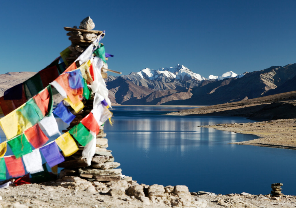
After Chumur, Charchagan La at 4,923 metres, and then the descent into the Tso Moriri basin. The lake appears below you as you come down — a long sweep of deep blue set into a wide high-altitude valley, with Korzok visible on the western shore. This is one of the most dramatic approaches to Tso Moriri that exists. Virtually nobody does it from this direction.
Stay: Camp or guesthouse, Korzok, Tso Moriri
Pass 16: Pologongka La — ~4,800 m / ~15,748 ft
From Korzok south to Sumdo, then west to join the Manali-Leh highway. Pologongka La is straightforward by this trip’s standards. The Morey Plains roll out between the passes — flat, windswept, empty at 4,600 metres, the sky enormous.
Camp at Pang or Sarchu.
Stay: Tented camp, Pang or Sarchu
Pass 17: Lachulung La — 5,065 m / 16,617 ft Pass 18: Nakee La — 4,739 m / 15,548 ft Pass 19: Taglang La — 5,328 m / 17,480 ft Pass 20: Baralacha La — 4,890 m / 16,040 ft
The Manali-Leh highway southbound delivers the last four passes in sequence. Taglang La at 17,480 feet carries the BRO sign that reads “Unbelievable is not the word” — which reads very differently after 18 days in the mountains than it does on a first Ladakh trip. At Baralacha La, pause at Suraj Tal below the pass. Then Jispa, Keylong, Atal Tunnel, and Manali.
Stay: Hotel, Manali
The mountains are visible in the rear mirror for the first hour south of Manali. Then the plains begin and everything becomes ordinary again. Stop in Mandi for chai. Think about where you have been.
Twenty passes. Five days in East Ladakh’s border corridor. The NPD road. The hidden lakes. Demchok. Umling La. Salsal La.
Most of India does not know these places exist. Now you do.
Days 7 through 15 cover the region that nobody is writing proper itineraries for. Here is the reality.
East Ladakh south of Pangong — Hanle, Koyul, Demchok, the Salsal La corridor — sits on or very close to the Line of Actual Control with China. The Indian Army manages this region. Checkposts are frequent, permits are verified carefully, and access to specific villages like Demchok and Chumur is subject to real-time military discretion. Your documents may be in perfect order and you may still be turned back on a particular day. This is not exceptional; it is normal for a border zone.
What this region gives in return for that uncertainty is the most raw and least touristed landscape in India. Passes like Nurbu La, Thit Zarbo La, Salsal La, and Charchagan La have almost no tourist traffic. The twin lakes between Hanle and Nyoma are unknown to the mainstream Ladakh circuit. Demchok is a divided village at the literal edge of the country. And Umling La at 19,300 feet is the summit of what is currently possible by vehicle on this planet.
The reason most people do not come here is that it requires genuine preparation, genuine equipment, and genuine flexibility. That is exactly what makes it worth doing properly.
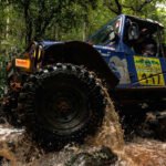
4×4 with high ground clearance is mandatory — Mahindra Thar, Scorpio N 4×4, Fortuner 4×4, Force Gurkha, or Jimny. Shinku La is restricted to 4×4 from Darcha in early season, and the NPD road, Wari La, Thit Zarbo La, and the East Ladakh sections require genuine 4×4 throughout.
Carry two full-size spare tyres. All-terrain tyres strongly preferred. The NPD road and East Ladakh sections have sharp rocks.
Fuel gaps to plan for: Keylong to Padum via Shinku La — 200+ km, no pump Padum to Leh via NPD road — fill at Padum before leaving Karu or Leh to Hanle and back through East Ladakh circuit — carry fuel for 800 km No pump at Hanle, Koyul, Nyoma, or Chilling Tso
Recovery gear: tow rope, two shovels, hi-lift jack, vehicle-specific spares, first aid, emergency satellite communicator for the East Ladakh section where mobile signal is zero for days at a time.
Read More:- Umling La Pass (2026): Route, Height, Weather, Map & Complete Travel Guide
Pay the Ladakh Environment and Development Fee online at lahdclehpermit.in before leaving Leh. Select Zone 13 for the full East Ladakh corridor. Approximately Rs 590 per person per week. Carry printed receipts.
For Demchok and Chumur: army checkposts have authority independent of the LAHDC permit system. Go prepared for flexibility on those days.
For Mig La if it opens to civilians in 2026: watch announcements from BRO and DC Leh. Additional documentation from the DM office likely required.
Hotel: Manali Days 1 and 17, Leh Days 5 and 6 Guesthouse or homestay: Padum, Lingshed, Nubra, Hanle x4, Koyul, Nyoma, Korzok x2 Wild camping: Gonbo Rangjon, Pangong, Chushul, Chilling Tso Tented road camps: Pang or Sarchu
This East Ladakh Expedition is not going to be easy. There will be rough roads, high altitude, freezing nights, fuel planning, army checkposts, and long stretches with absolutely no mobile network.
Some days will test the vehicle, and some days will test us. But that is exactly what this journey is about. This is not the usual Ladakh holiday route — it is a real overlanding expedition through some of the most remote and least explored roads in India.
I am not a tour operator, and this is not a commercial package tour. I am simply planning this drive because I want to experience these mountains properly. If any of you seriously want to join, bring a proper 4×4, come prepared, and message now on the Jimny Club Haryana Instagram page.